ASSESSMENT OF AFFORESTATION AND DEFORESTATION DYNAMICS THROUGH NDVI IMAGERY ANALYSIS
Read Full ArticleKeywords
- Afforestation
- ArcGIS
- Deforestation
- LANDSAT
- NDVI
Magazine: April-June 2025
Page: 30 - 35
Volume: 5
Issue: 2
Issue Date: 10 July 2025
Abstract
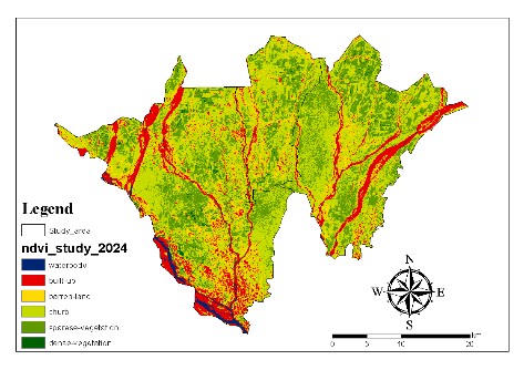
The Normalized Difference Vegetation Index (NDVI) derived from satellite imagery is a powerful tool for monitoring vegetation dynamics over time. NDVI utilizes red and near-infrared (NIR) reflectance to assess vegetation health and density. In this study, LANDSAT data from different time periods were processed and analyzed using GIS techniques to assess spatial vegetation trends. NDVI rasters were reclassified into vegetation and non-vegetation classes and compared across timeframes to evaluate changes. The results indicate a general decline in vegetation density over the years, despite localized afforestation efforts. This methodology demonstrates the utility of NDVI analysis in environmental monitoring and sustainable land-use planning.